The Historical Side Of Land Surveying

Historians aren’t quite sure who made the prehistoric monument at Stonehenge, but they know that early surveying equipment was used. In fact, most ancient civilizations relied on simple geometry and surveying tools to establish land borders and boundaries for building, farming, and city planning. The Romans, for example, built the most advanced system of roads the world had ever seen with the help of land surveyors. Here’s a brief look back at how the profession has changed since those early days.

Equipment: Development and Improvement

Before the 18th century, most surveyors used ropes and chains to measure distance. The great leap forward occurred in 1787, when the first precision theodolite was introduced. The instrument simultaneously measures angles on both vertical and horizontal planes. It helped surveyors quickly and accurately measure angles to distant points, which was invaluable for map making.

But as important as the theodolite was, surveyors still had to manually measure distances to ensure precision. It was not until electronic distance measurement (EDM) was developed in the 1950s that they could finally put away their ropes and chains. The device utilizes microwave transmitters and receivers to determine long distances. Building on this advancement, instruments that measured both distance and angles came on the scene in the 1970s. Known as total stations, their speed and accuracy have continued to improve at an impressive pace. Modern stations can even be operated by remote control!

At present, the theodolite and the total station are considered essential pieces of equipment for professional surveyors. Although GPS technology has come a long way in recent years, it does not yet provide the accuracy and precision professionals need to do their job. As such, GPS equipment is rarely used to the exclusion of more trusted surveying tools.

Measurement Conversions

Because most surveying tools use the metric system, U.S. surveyors must convert their measurements from meters to feet (1 meter = 3.28 feet). Even more confusing is a unit of length and area known as a rod. Used primarily in older property deeds, one rod is equal to 16.5 feet. For federal surveyors who complete U.S. public land surveys, an ancient measurement unit called a chain is still in use. Originally consisting of 100 iron links that were nearly eight inches long, a standard chain is 66 feet in length.

Although the tools and technologies have changed, many ancient units of measurement are still in place today. For the average residential surveyor, it is often enough to simply convert metric measurements to imperial (U.S.) ones. But for federal surveyors, a more complex system based on ancient measurements is still in use.

The Flats East Bank: A Second Chance

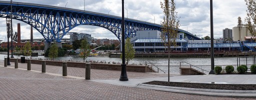
The East Bank neighborhood of Cleveland, Ohio is back and better than ever. On the East Bank, which overlooks the historic and stunning Cuyahoga river, a redevelopment project is under way that will bring out locals and tourists alike to enjoy a stroll down the newly constructed riverfront boardwalk, stopping along the way in the numerous new and thriving shops, restaurants, and bars. This project, named after the areas low-lying topography, is called Flats East Bank.

The Vision

With the help of the investment partnership between Wolstein Group and Fairmount Properties, the East Bank will soon be reawakened and redeemed. The partners have generously devoted $750 million to fulfill their vision of redeveloping this iconic neighborhood so that the locals and tourists of Cleveland, Ohio will have an intriguing new scene to explore and enjoy.

Wolstein Group envisions the Flats East Bank as a showcase for the city of Cleveland. It will be a hub of activity, and it will cultivate a sense of appreciation among Clevlanders who love their hometown.

The Plan

Phase I of the project, which is already complete, has welcomed new additions to the East Bank, such as a variety of local restaurants and bars, a contemporary fitness center, a chic hotel, and a 23-story office tower. Phase II, which will integrate entertainment venues, a residential building, additional restaurants, and a waterfront boardwalk, is in the midst of construction. Additional planning for the final phase is currently underway, but phase III will add up to 100 residences, a movie theater, and street level retail. When the final phase is complete, the Flats East Bank will offer over 500 parking spaces, over 14 dining and entertainment options, and endless opportunities for fun.

It’s A Community Effort

The city and the county are in active support of the reconstruction, and Mayor Frank G. Jackson even attended a ribbon-cutting ceremony on October 1st to celebrate the progress of the construction. Local Clevelanders are ecstatic as well, stating that before the reconstruction, the reputation of the East Bank was less than inviting, but now they are thrilled with the positive changes that are taking place.

Second chances do not come along often, but through the generosity of noble donors and investors, the Flats East Bank has been given another opportunity. The rejuvenation of this waterfront locality will bring people together to live, work, and play downtown, just as the Wolstein Group envisioned. The Flats East Bank is finally experiencing a rebirth. Soon the transition back into the local hub, entertainment destination, and beloved community that it once was will be complete. We can’t wait to see what the future holds for Flats East Bank!

Understanding Different Types Of Land Surveying

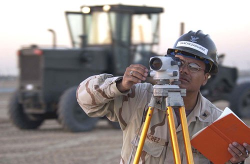
man surveying land - Garrett and Associates

Because banks usually require a land survey before they approve a mortgage loan, most homeowners are acquainted with property surveys. Performed by a licensed land surveyor, these surveys confirm the legal boundaries of residential and commercial properties. Because buying and selling properties is an everyday occurrence, this service keeps surveyors busy all year round. With that said, there are many other surveying services they provide.

ALTA Surveys

A more comprehensive property survey, the ALTA survey includes mortgage, boundary, and topographic surveys. More commonly used for commercial properties, these surveys are popular because they guarantee a single, universal standard all companies can agree on.

Mortgage Surveys

Mentioned earlier, mortgage surveys determine the land boundaries of a property. They can also calculate the location of any structure, such as a home, apartment building, or condominium that is located on the land. The main reason lending institutions require these surveys is because they want to make sure any structures on the property meet current building and zoning codes.

Topographic Surveys

Used to pinpoint the location of both natural and man-made features, topographic surveys are sometimes required by the government. They generally include trees, streams, fences, and detached structures. Much like some maps, they use contour lines to indicate relative elevation. Often used by architects and engineers, topographic surveys help them plan certain projects more precisely.

Construction Surveys

Important tools through the entire construction process, surveys help engineers, builders, and architects plan their next steps. All projects begin with a site or plot plan that lays out the plan for the entire project, from start to finish. There are also as-built surveys that confirm that all authorized work was completed according to the specifications set forth in the plot plan. Lastly, a foundation survey is completed as soon as the foundation of the building has been cured. Its purpose is to verify that the foundation was poured in the proper location and according to accepted standards.

Deformation Survey

Generally used on public lands, such as parks, a deformation survey helps determine if an object or structure is changing shape or moving. If, for example, a birdwatching tower were believed to be sinking into the ground, a land surveyor would record the specific points of the tower in order to determine its exact position. He or she would then wait for a certain period of time before retaking the measurement points. If the points were different, the surveyor would report that the tower is indeed sinking.

Hydrographic Survey

It may make their job title a misnomer, but land surveyors also perform bathymetric and hydrographic surveys on bodies of water. To do so, they must measure things like water depth, water levels, bottom contours, and direction of the current (if there is one). For navigational purposes, they must also record the location and position of landmarks and other fixed objects.

Although this is only but a partial list, the aforementioned options are the most common types of land surveys.

Five Historical Figures Who Were Land Surveyors

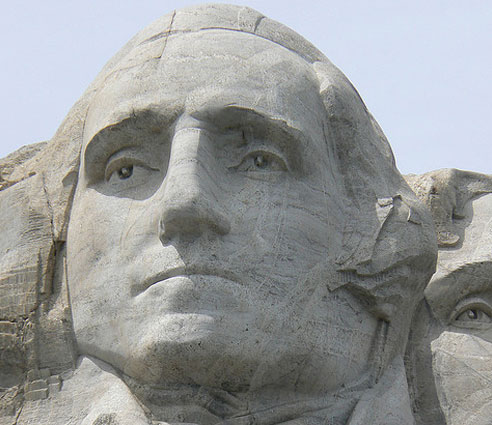
Photo Of George Washington On Mt. Rushmore - Garrett and Associates

In addition to being brave men and women who accomplished monumental things, several famous names from American history were also land surveyors. Here are five of them.

George Washington

Not only was he a great general and the first U.S. President, but George Washington was also an experienced land surveyor. Starting as a teenager, the strapping lad would go on to survey over two hundred tracts of land in his life. The skill served Washington well, helping him acquire more than 65,000 acres of land in thirty-seven locations. At the time of his death, he was one of the wealthiest landowners in Virginia.

Thomas Jefferson

Another U.S. President from Virginia, Thomas Jefferson was a Renaissance man who explored numerous fields of knowledge—one of which was land surveying. Appointed County Surveyor for Albemarle County, Virginia in 1773, he would use the skills he acquired in that post as Secretary of State (under President Washington). According to historians, Jefferson helped manage teams of federal land surveyors who were responsible for the orderly settlement of the frontier.

Abraham Lincoln

Before he was a small-town lawyer and a U.S. President, Abraham Lincoln was a local land surveyor. Appointed Surveyor for Sangamon County, Illinois in 1833, young Lincoln was responsible for surveying roads, boundary lines, town lots, and settling boundary disputes.

Daniel Boone

Not every famous land surveyor was also a U.S. President. Daniel Boone was a early American explorer, woodsman, and pioneer. His intimate knowledge of the wilderness that is now Kentucky made him the few men qualified to survey the land of that region. As such, he was named Deputy County Surveyor for Lincoln County, Kentucky in 1783.

Lewis & Clark

Shortly after President Thomas Jefferson completed the Louisiana Purchase in 1803, he commissioned an expedition to explore the new lands. Captain Meriwether Lewis and his friend, Second Lieutenant William Clark, were put in command. Both men had studied surveying; Lewis had been taught the subject by President Jefferson, while Clark had learned land surveying and mapping in the army. On the expedition, Lewis was responsible for most of the celestial observations, while Clark drew most of the maps.

A challenging profession, land surveying was instrumental to the creation of every modern nation. Because the United States was once an uncharted wilderness, many of its most famous citizens studied the science at some point. Some of them even accomplished great things with the help of their training.

Photo Credit: James Hawley

How Technology Is Shaping The Future Of Land Surveying

Photo Of A Land Surveyor - Garrett & Associates

Technology has forever changed the ancient art/science of land surveying. Although experts still rely on old-fashioned tools of the trade, such as compasses, levels, and measuring wheels, modern gadgets help them collect information a lot faster. New equipment and techniques have undeniably altered the profession, making it much broader than it was in the past. Many surveyors now see themselves as project information managers, rather than outside consultants who complete a few specialized tasks. Here is a list of the equipment they might use.

Total Station Theodolite – A modern version of an ancient tool, the total station is a theodolite, or transit, that is equipped with an electronic distance meter. Capable of reading slope distances to specific points from hundreds of yards away, the tool can save surveyors hours on mapping, stakeout, and property line surveying.

3-D Laser Scanner – With the help of this invaluable instrument, surveyors can now create digital 3-D models that help architects accurately visualize the land they will be building on.

Satellite Positioning Systems – Once considered a luxury, GPS technology is now an essential surveying tool experts use to collect data in the field on a daily basis.

GIS Software – The same software that runs programs like Google Maps is utilized by surveyors to create digital maps of nearly any area. Helpful in establishing property lines, these maps are widely used in construction projects of all sizes.

Deep Tows – Contrary to popular belief, surveyors don’t only work on dry land. Some of them explore the ocean floor with equipment called deep tows. These underwater survey systems use sonar or cameras that are towed by vessels to capture images of the ocean floor, which may later be used for academic or construction purposes.

Drones – Many forward-thinking surveyors believe that drones are the biggest thing to happen to the profession since the compass. Inexpensive and easy to operate, these unmanned aircraft are the ideal platform for remote sensing and aerial photography. With the information drones can collect, surveyors can simply and affordably provide accurate measurements, maps, and models of any size project.

New technologies have given surveyors the ability to take a more active role in the construction cycle, from beginning to end. Because the information they collect, analyze, and interpret is needed at all steps and stages of the process, surveyors are fast becoming active members of the management team.

Land Surveying History: More Than Meets the Eye.

Garrett & Associates

Wherever monuments were built in the ancient world, wherever man raised his eyes to the heavens and built on earth, a surveyor was there. Whether the circles of Stonehenge, the pyramids of Egypt or South America, the ancient temples of Greece and Rome, all were laid out with specific relationships that codified the relationship between the people, their government, and their deity.

The earliest recorded surveys were conducted by the ancient Egyptians. Famous for their monuments, they are perhaps best known now for the only remaining structure of the original “Seven wonders of the world,” the Great Pyramid of Giza. For 3,800 years the tallest structure in the world, it’s almost exact north-south orientation and precise geometry are a testament to the surveyors who laid out the plan using little more than knotted ropes and plumb bobs. But the Egyptians used surveying for more than establishing their monuments, there are 4,000 year old clay tablets establishing property boundaries for ownership and sale of land. These provided the basis for the Egyptian economy, for agriculture, and for trade throughout the region. As the Nile river flooded each year, washing away boundary markers, surveying was an annual necessity for the continuance of a civil society.

As Greek civilization grew they looked to Egypt, as the Romans in turn looked to Greece. Around 522 B.C.E. it was the engineer Eupalinos who dug the underground aqueduct that bears his name on the island of Samos. Over a thousand meters in length, the tunnel was dug through solid rock from both ends simultaneously, tunneling through a mountain to provide an uninterruptible water source for the town. Without exact measurements the two tunnels may have never met, but Eupalinos managed the feat with tremendous accuracy, using nothing more than Geometry and a perhaps a forerunner to the surveying instrument invented by the Greeks, the Dioptra. A disc leveled by screws and inscribed with angles, the dioptra could be used to determine the angle between two distant objects from a fixed point.

The Romans adapted the Dioptra, and well as a Mesopotamian tool they called the Groma. Together with spirit levels and odometers, these tools provided surveyors and engineers with all the information necessary to lay out colonies, build cities and monuments, aqueducts and roads, some of which are still in use today. At it’s height, the Roman water system used eleven separate aqueducts spanning almost 400 kilometers to bring over one million cubic meters of clean water into the city every day.

It wasn’t until the 16th century that the Theodolite came into use. A precision instrument for measuring angles in both the horizontal and vertical planes, it has survived into the modern era with continual upgrades. In the United States, George Washington, Daniel Boone and Lewis and Clark are but a few of the surveyors whose use of the theodolite had profound impacts on the young nation’s history. In civil engineering circles, Mt. Rushmore is often jokingly referred to as “three surveyors and some other guy,” though there is a move afoot to consider Theodore Roosevelt a surveyor as well. His famous 1913-1914 map-making expedition to Brazil resulted in a river there being named after him (Rio Roosevelt, sometimes known as Rio Teodoro) and almost cost him his life.

Modern theodolites now come equipped with infra-red based measuring devices, software, and may even be remote controlled. Though the technology has changed, the goal remains the same as it has been throughout land surveying history: to quantify the unknown.

Garrett & Associates Performs ALTA Land Survey for Sale of Skylight Office Tower

Earlier this month, Cleveland-based Forest City Enterprises, Inc. sold its Skylight Office Tower to an affiliate of the Hertz Investment Group, and Garrett & Associates performed the ALTA survey on the buyer’s behalf prior to finalization of the $35.4 million sale.

What is an ALTA survey?

The American Land Title Association is a trade association made up of title insurance companies, title and segment agents, and other professionals involved in the titling process of commercial real estate transactions. ALTA sets certain standards for the coordination, titling, and ordering process, holding all titling companies to the same standard and protecting property owners and lenders against losses from defective titles.

Garrett & Associates proudly worked with the buyer to perform the ALTA land survey, which accurately recorded the Skylight Office Tower property’s boundaries, highlighted all improvements made to the property (including buildings, walkways, parking lots, utility poles, and more), and recorded the locations of all utility and access points and other vital information.

Sale of the Skylight Office Tower

Forest City Enterprises estimated that the sale would generate about $34.2 million in net proceeds after closing costs and commissions. This is the second property in the Cleveland area purchased by the buyer; Hertz Investment Group purchased Fifth Third Center on Superior Avenue earlier this year.

The 321,000 square-foot building is part of the Tower City Center complex, home to a variety of businesses, from office buildings and hotels to shops, restaurants, and even an entertainment venue. Located on West Second Street, the 12-story building consists mostly of offices and is home to the federal public defender, a number of prominent local attorneys, the Cleveland Plain Dealer’s newsroom, the Sherwin-Williams Co., and several other clients.

Garrett & Associates Surveying Services

Garrett & Associates is the premier land surveying firm in the Cleveland area. Our fully licensed and experienced surveyors use the most advanced equipment to provide accurate, detailed land surveying solutions to local companies. We pride ourselves on our quick turnaround, affordable prices, and outstanding, personalized service offered to every client. Contact us today to learn more about our land surveying services or our involvement in the sale of the Skylight Office Tower!

Garrett and Associates Contributes to Renovation of the Temple-Tifereth into Performing Arts Center

Rhythm & Cranes

Garrett and Associates, one of Cleveland’s top land surveyors, provided surveying services to aid in the renovation of the Temple-Tifereth. The building is now part of Case Western Reserve University, serving as its new center for music, dance, and the performing arts.

The architectural masterpiece was designed and built during the early 20th Century by Charles Greco, who was influenced and inspired by the Romans and Byzantines. The Temple was essentially donated to CWRU after its congregation established a deal that would allow them access to the facility for the next 99 years on eight major holidays each year, and for other events as established with the university. The Temple is now known as CWRU’s Milton and Tamar Maltz Performing Arts Center.

The renovations have enhanced the integrity of the Maltz-Temple building’s structure while maintaining its original character. One of the biggest enhancements was a 66,000-pound glass and steel acoustical canopy purchased by the university to enhance acoustics of performances at the venue, which also features an expandable stage and various seating areas.

The performing arts center renovation was just the first phase of the university’s Maltz-Temple project. The next goal for the university is to secure the remaining funding needed for Phase II of the project, which involves expanding the Temple’s existing classroom wing and creating additional theater and rehearsal spaces for students. This expansion will allow CWRU to eventually move the theater and dance programs into the building; currently the Temple is only being utilized for concerts and university events.

The university held a “Violins of Hope” concert on September 27 to celebrate the venue’s transformation into a performing arts center. The sold-out performance featured members of the Cleveland Orchestra and soloist Schlomo Mintz performing on violins that were once played by Jews imprisoned during the Holocaust. The university anticipates holding between 20 and 30 programs each year for students and community members at the Maltz-Temple building.

Garret and Associates is proud to have played a role in helping Case Western Reserve University bring the community even greater access to cultural and performing arts events through the Milton and Tamar Maltz Performing Arts Center. We’re committed to giving back to the community, and there are few better causes to support than the arts!

Have you seen the renovations yet? What were your thoughts?

Special thanks for José Manuel Ríos Valiente for the crane image.