New Technology Makes Surveying More Accurate

Throughout history, the surveying field has used the latest technology to create accurate readings of the land and structures on it. New technological advancements are now allowing surveyors to create three-dimensional models in shorter times with greater accuracy.

Computers Help Make It Easier

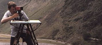
Today’s advancements are no different. With the latest technology, surveyors are able to digitally map the location and calculate distances that are hundreds of meters away. The new total station can be easily operated by a single surveyor. By using a remote control at the operating station, robotic drones can be sent to map an area.

In conjunction or in place of the robotics, a 3D laser scanner allows surveyors to understand the shape and angles of the surface of the land and any buildings on it. The data collected by the instruments are then used to create a three-dimensional model for architects.

Global Positioning Software allows the team to use satellite technology to pinpoint data on land. Since the satellites do not require a line of site between the two points, surveying of larger land areas happens in a shorter amount of time. It also reduces the number of surveying teams needed to complete a large job.

Along with the GPS technology, new GIS software captures this data. The computer processes this information to create a digital map of the area. Map designers produce larger area maps quickly and accurately. Online services such as MapQuest and Google Maps are some examples of groups using this technology.

Technology Helps Save Shorelines

Autonomous underwater vehicles are an essential piece of technology utilized by surveyors. These systems are outfitted with cameras and sonar to read the shoreline in a given area. In the event of an oil spill, this technology can help shoreline cleanup and assessment teams determine how spills will affect the environment.

Breathing New Life into the Surveyor Career

Surveyors determine the three-dimensional positions on the Earth and the distances and angles between them. This information is used to create maps of an area. It is also used to establish boundaries for owners and to situate new buildings on properties. It is a profession for those with brains and creativity.

Education

In order to begin work in the surveying field, it is important to have a college degree. While there might not be a specific “land surveyor” major at most traditional universities, those who wish to enter this field must have a firm understanding of mathematics. The areas of geometry and trigonometry are essential to calculating the angles and distances between objects. Additionally, surveyors need to have experience with engineering and physics if they want to specialize in construction.

Many technical colleges offer both associate and bachelor’s degrees in mapping, geomatics, and even surveying. These majors are certain to help students reach their surveying career goals and help get them on the road to state licensure in this field.

The computer boom has made the use of computer software an integral part of the job. Computing power allows for better statistical analysis and the creation of metadata in order to have more accurate positional information. In order to continue to develop these programs, new surveyors should seek an understanding of programming code.

Paths of the Surveyor

Surveying is a diverse career with many unique paths to choose from. For example, those who want to create aerial maps and enjoy photography may consider the path of a photogrammetrist. In this specialty, the surveyor takes aerial photos of terrain in order to create detailed three-dimensional maps, which include topography, existing structures, and vegetation. The maps are used to help track oil spill movements in order to determine any coastal community impact.

Another interesting specialty in this field is that of forensics. Forensic surveyors analyze, collect data, and map areas for use as evidence in impending court cases. Some examples would be boundary disputes, vehicular wrecks, and industrial accidents. Those choosing this path must be able to communicate effectively. They need to understand the technical aspect of surveying while being able to explain it in a non-technical way to laymen.

There are also other paths surveyors can choose, including:

– Hydrography

– Geodesy

– Topography

– Construction

GIS Analyst

Surveying is anything but a boring career. It provides an outlet for a wide range of skills including physics, mathematics, photography, cartography, and forensics. It’s perfect for professionals who want to get out of the office and break the 9 to 5 routine.

Surveying Shoreline Damage After Oil Spills

Oil Spill Image - Garrett and Associates

First responders to an oil spill must examine the area to determine the extent of the damage. This team uses the Shoreline Cleanup and Assessment Technique, also referred to as SCAT, to survey shorelines and submit their findings.

How SCAT Works

This assessment method collects information about the oil spill and the shoreline environment that will potentially be affected by the spill. The goal of SCAT is to determine the extent of the damage and provide recommendations for the most effective cleanup that will result in the least negative impact on the environment.

The First Responder Team

The team of experts generally includes officials from both state and federal government agencies. The organization responsible for the accident can also place employees on the SCAT team. The first responders work together to categorize the spill and the type of oil found on the scene. The team also assesses the specific types of shoreline involved, as this determines the extent of the damage and the best methods of cleanup.

Recommendations

After full examination and analysis, the SCAT team uses the resulting surveys to make a formal recommendation for cleaning up an oil spill. Large oil spills usually take significant time and effort to gather the required data. Photographs and GPS tracking are part of the data utilized with surveys. Once collected, the team enters data into a central database, which all interested parties can access to gain information about the spill.

With a combination of technology and fast response, SCAT teams work to minimize damage and protect the environment.

Thanks to Green File Productions on flickr for the image used in this post.

The Power of Air Rights

Air rights address the space above a property. It was declared in 1797 that space was unlimited—according to the Latin phrase, “For whoever owns the soil, it is theirs up to Heaven and down to Hell.” However, after airplanes had taken flight about 125 years later, air rights of property owners were limited to “within the range of actual occupation.”

Definition of Air Rights

Air rights refer to the “right to control, occupy, or use the vertical space (air space) above a property, subject to necessary and reasonable use by neighbor(s) and others (such as aircraft).”

Theory and Law

Air rights regulations specify that property boundaries do not reach endlessly into the air. Federal legislators established public easement for airspace above 500 feet, but most local zoning districts have their own limits for the empty air space above a building. Zoning districts, for example, might pass stricter air rights regulations in residential neighborhoods so that a developer cannot build a high-rise office building. The laws restrict construction, even though the air above belongs to a private party. Air rights zoning services can help define the exact limits of a residential or commercial property’s air rights.

Air Rights and Aircraft

The federal government determined that the public has the right to freedom of travel in the navigable airspace above the United States, and local ordinances must not conflict with these federal laws. Every traveling aircraft, however, is subject to regulations that are usually connected to the owner’s enjoyment of the property.

Buyers and Sellers

Air rights can be sold, bought, and leased, and they are generally considered more valuable in denser urban areas. When purchasing a property, the acquisition of air rights leaves the door open for future development projects, making them especially valuable for commercial developers.

The Importance of Air Rights Case Study: Manhattan

Nowhere in the United States are air rights laws more influential than New York’s borough of Manhattan. As the nation’s most densely populated area, Manhattan’s air rights can spell the difference between a modest or extremely lucrative real estate endeavor.

In February of this year, the average price per square foot for a Manhattan condo was $1,781. The national average is $64. At an average cost of $225 per square foot in Manhattan, New York City’s air rights are more than three times that of most homes in the country. Three years ago, Manhattan’s air rights had risen by 47 percent in a single year. Now, some developers are paying the same price per square foot of air space as they did to buy the lot. The reason? Air space in Manhattan has been transformed into new and higher floors.

To learn more about air rights and air rights lot spill, contact Garrett & Associates.

County Website Updated with GIS Data

Picture Of A Map - Garrett and Associates

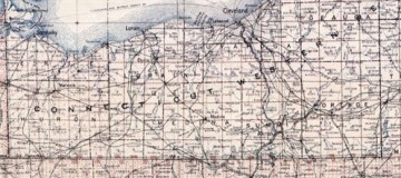
GIS has improved many industries over the years, especially smartphones and GPS applications. By using spatial and temporal information, GIS lets users interact with data as it relates to maps, satellite images, and land topography. Cuyahoga County has compiled property and zoning-related information on a map on the county’s website.

Access From Home

This map offers a much-improved GIS system that allows the public to access property tax and ownership information. Users can get this information from the county’s website simply by using the map to locate title deeds and property taxes for specific places. The map also offers permit information and building sketches for proposed building projects. While these records have always been open to the public, they can be accessed faster and more easily now with this upgraded system. In the past, people would have had to request this information from public records downtown. Now people can access this information much more quickly from home or at a library computer.

How GIS Comes Into Play

The Cuyahoga County map uses spatial/temporal data. The spatial portion refers to the map. But when users click “full map,” they have the option to search records as far back as 1993. Choosing this feature refreshes the map and allows users to search property information from different years. This feature is one small example of the pros of using GIS data to create user applications. Formatting this data into an online map saves people time and effort, and it allows them to quickly jump through the years to search out tax records.

Who Benefits From This System

This information is valuable to future homeowners who can access the property tax information for specific areas, helping them find an area that best suits their price range. The same is true for someone looking to open a small business. Potential business owners can find out what the property tax will be in certain places, helping them find the location that best suits their needs. Business owners can also find permit and zoning information on a building they wish to purchase. Some downtown buildings may have out-of-date permits. Those wishing to purchase that building can find out whether the city inspections are up-to-date, helping buyers locate that safest and most suitable building for sale. Real estate appraisers may also benefit from this system, allowing them to more quickly gather information in order to make accurate appraisals.

Title deed, property tax, and building permits have long been considered public record. Using this new system helps users quickly access this information for whatever purpose necessary. This system is just one small example of how GIS applications can save time and effort for people, making data more accessible and more navigable for the everyday user.

Rainwater and Land Development

surveyor mapping mountains

A half-century ago, urban cores of many major American cities went through a protracted process of hollowing out as people flocked to the open space and safety of the suburbs. Now, affluent and educated young people are returning to the inner cities. This new urbanism is a documented socio-spatial phenomenon. Cities like Detroit, Cleveland, New Orleans, and even Atlanta, once foster children of urban blight, are experiencing a revitalization. Part of this redevelopment is adapting city spaces to benefit from natural processes. Managing and utilizing rainwater has become a major component of modern strategies for sustainable, ecologically harmonious city centers.

Land development can have a major impact on the entire hydrologic cycle. Paved, impervious surfaces do not absorb water and are often designed and graded to expel it as fast as possible. This means that during storms, places further down the watershed from areas with little or no permeable surface are subject to flash floods as water that would ordinarily be absorbed in the soil washes over. Further, roads and parking lots often make up a significant portion of paved urban space and they are also the most exposed to hydrocarbons. Oil/gas and other substances leaked or emitted from engines gather on theses surfaces and rain washes them into nearby watersheds. Perhaps most importantly for areas that rely on aquifers for their drinking supply, asphalt and concrete act as barriers between the rain and the groundwater. Even in places that use river water for municipal supply, surface waters are often directly linked to groundwater so that less percolation into the ground reduces stream flows except to points where drainage infrastructure is directed, which is often downstream from water treatment intakes.

One example of a city that is rethinking the way land use interacts with rainwater is New Orleans. Recently, the city won a $141 million grant to construct a resilience district. New Orleans, mostly at or below sea level, has a long history of fighting water, using massive pumps to expel the rain. Now, however, at least one neighborhood will build green space and open canals that hold and absorb the water, rather than impervious surfaces that allow it to pool.

New Orleans is just one of many areas where green space, catchment basins, and beautiful canals are being used. Established cities and new developments alike are getting smart about managing water, our most precious resource.

Top Five Sediment Control Methods

Sediment control is an important part of maintaining a site. If not implemented, these areas easily become eroded. Wash off from some areas can pollute nearby streams, lakes, and rivers. The following methods offer the best protection and control.

Inlet Protection

One popular type of control is an inlet protection. Drop inlets are secured either around, above, or below the sewage grate. These appliances are often made of non-woven geotextiles. Some are made of synthetic fiberboard or wood chunks. For the drops used below sewer grates, an overflow opening is built-in to the design.

Curb inlet protection apparatuses are often tubing covered in a geofiber fabric. Sometimes the PVC is wrapped in polypropylene material. These products are placed in front of curbside inlets, keeping out sediment, pollutants, and debris from entering storm drains. This protection device does have an overflow gap and filter built in to keep the street from becoming flooded during use.

Perimeter Control

If the construction site is larger than just small repairs along the road, a perimeter device is necessary. Perimeter controls are put in place as a temporary measure, just until permanent ground covers can be put in place. There are several different types of apparatuses used for this task.

Sediment control fences provide a barrier that slows the runoff. It also helps to keep all sediment inside the work site and limits the filtering of sediment out of the site.

In addition to fences, sidewalk barriers help to transport the sediment off-site. This is a temporary trap for runoff. These may be used in conjunction with storm drain inlet devices.

Sediment Traps

In addition to placing barriers around inlets and construction sites, sediment traps are often employed. Scientists usually use these traps to study the quantity of particulates in lakes, rivers, streams, and oceans. However, they can be used in any water system to trap some sediment and keep the runoff from getting into the ecosystem.

Concrete Washout

Making and washing concrete is a major contributor to contamination. A washout helps to contain the runoff. A berm works with mixers, trucks, and wheelbarrows. It allows the concrete to be poured directly in and used. The berm then allows the contaminated water to evaporate safely.

For those who need something that will filter liquid and recycle aggregate for several washouts, a concrete filter is a better option. While it won’t work as well with wheelbarrows, it is compatible with trucks and mixers. The filter pulls sediment from water and reduces the pH. This allows the water to discharge into vegetation when finished.

Check Dam

Check dams are a final way to control sediment at a worksite. This is a temporary structure placed over a drainage ditch, waterway, or swale. This structure interrupts water flow. It also flattens the channel gradient, slowing the flow of water. These structures have been known to collect sediment, however, they should not be the first choice for sediment control since they are not intended for this purpose.

Gaining Perspective on Zika

On February 1, the World Health Organization declared a state of emergency due to new evidence that linked Zika Virus to microcephaly in newborn babies in Brazil. Microcephaly leads children to be born with unnaturally small heads and underdeveloped brains, and plays a significant role in the emergence of neurological disorders including seizures, hearing and vision loss, and poor motor control skills. Naturally, many expectant parents watched with concern as doctors and doomsayers began to speak out about this mysterious virus.

Humble Beginnings

The Zika virus was first identified as a transmittable agent in 1947 by researchers working in the Zika Forest. However it took five years for researchers experimenting on Rhesus monkeys and mice at the East African Virus Research Institute in Entebbe, Uganda to isolate the Zika pathogen. These researchers discovered that much like Dengue and Yellow Fever, Zika is transmitted through the Aedes Aegypti mosquito, which commonly inhabits Africa, Southeast Asia, the Americas, and the Pacific Islands. Although neurons of infected mice showed damage, it was uncertain that Zika could induce any symptoms in humans until renegade researcher William Bearcroft injected himself with the virus strain in 1956 and experienced a mild fever.

Despite its relatively long history, the medical community previously showed little concern over Zika because cases were isolated and symptoms mild. Although common symptoms include chills, skin rash, and conjunctivitis—reddening of the eyes—many people may be exposed to Zika without experiencing any symptoms at all. There are no known treatments or vaccines. Until recently, there was no demand for one.

The Tide Changes

In 2007 opinions towards Zika began to change. That was the year doctors treated the first major outbreak on Yap Island in Micronesia. Forty-nine current cases were diagnosed and 73 percent of residents older than three years old showed evidence of previous infection. Next, French Polynesia experienced a serious outbreak. As of today, 52 countries have reported cases of Zika, most recently Brazil. All of this would be typically viewed without much concern, were it not for the increased incidents of occurrence in tourists combined with potential links discovered between Zika and congenital disorders in unborn infants in Brazil.

Despite the panic, there’s still not a lot of consensus among the medical community about potential risks of Zika, means of transmission, and the scope of the risk. Dr. Peter Hotez of the Sabin Vaccine Institute warns of impending disaster. However, according to doctors from the Centers for Disease Control and Prevention, there is no cause for fear in the United States. Basic precautions like bug spray, protective clothing, and mosquito nets are the most effective way to avoid infection in high-risks areas. For expectant mothers, the CDC and WHO recommends avoiding travel to countries like Brazil where Zika is active.

Due to the amount of time and work that goes into making credible scientific discoveries, it is likely that the history of Zika will continue to unfold for years to come. As medical research continues, by staying aware of new findings, it is possible to weigh the risks and make informed decisions.

Ohio Dam Safety Program Keeps Citizens Safe from Disaster

Photo Of The Hoover Dam - Garrett and Associates

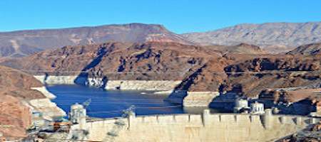
The Ohio Department of Natural Resources (ODNR) has showed its commitment to dam safety by establishing the Ohio Dam Safety Program, which allows businesses and residents to continue to use the state’s many lakes and reservoirs for business or recreation without sacrificing the safety of those downstream. Dam and reservoir failures can lead to countless injuries and deaths, millions of dollars in damage, and displacement of citizens, so it’s important that dam safety be a priority in Ohio.

Why is Dam Safety Important?

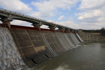
While modern dams are hugely beneficial to Ohio communities, they also pose potential safety hazards. Over the last century, high-profile dam and reservoir failures have devastated communities across the U.S., killing hundreds of people and displacing even more. Dam failures can occur in the blink of an eye, so it’s important for dam operators, safety officials, and community members to be prepared for such a disaster in their own communities. One way to prevent this devastation is to identify signs of failure before disaster strikes, allowing for time to evacuate citizens and, if possible, make necessary repairs to the structure.

What Causes Dam Failure?

There are three main concerns when it comes to dam failure. The first, accounting for about one-third of all dam failures in the U.S., is called overtopping. Overtopping often occurs when the spillway has been poorly designed or has been blocked by debris, causing structural damage or allowing water to crest over the top of the dam. Foundation defects contribute to another 30 percent of dam failures. These dams are often poorly designed and experience problems related to settling, slope instability, and other preventable issues. Another cause of dam failure is piping, which occurs when water slowly seeps through pipes, spillways, foundations, and other sections of the dam, causing internal erosion that weakens the structure. Piping issues account for about 20 percent of all dam failures in the U.S.

About the Program

The Dam Safety Program was established by ODNR to keep Ohio’s citizens safe while allowing residents and businesses to continue to reap the benefits of the state’s many dams. The program holds dam owners accountable for maintaining the condition of the dam and eliminating risks to civilians.

The program operates on a five-year schedule, with every dam or levee undergoing a thorough inspection during each five-year period. The ODNR has also partnered with the U.S. Environmental Protection Agency and the Ohio Environmental Protection Agency to provide similar inspections of coal ash impoundments across the state. Thanks to FEMA funding, the state has also implemented an Emergency Action Plan to educate the public on emergency procedures for dam-related disasters. Additionally, the program seeks to modify safety and structural requirements for construction of new dams and reservoirs, including offering discounted fees for dam owners in compliance with the new rules.

For more information about the ODNR Dam Safety Program, visit the ODNR Division of Water Resources online.

Photo Credit: Stephen Kruso

What the FAST Act Means for Highway Funding

Maintaining roadways is an important part of every city, state, and the federal budget. As recently as 2015, the government has been working to increase federal funding for highway improvements. The House and Senate finally agreed in December to extend the federal transportation funding for an additional five years.

Use It, Pay for It Approach

In order to fund any repairs and upgrades to the highways, the government has taken the stance, “If you use it, then you should help pay for it.” Consumers do this, in part, through the purchase of fuel. Thanks to the gas tax, the Highway Trust Fund is able to make the repairs necessary.

Unfortunately, this fund has been hit hard with rising costs to maintain the roads traveled every day. This is because, unlike the supplies needed, the tax has not been raised since 1993. For some reason, government officials have chosen to freeze this source of income at 18.4 cents per gallon. If the tax had risen with inflation, it would be closer to 33 cents per gallon at this time, almost double where it is currently resting.

Bill Passed in Dec 2015 Shifts Burden

The federal government is trying to add money to the Highway Trust Fund. In a last-minute save, the House and Senate agreed to a new federal funding bill on December 1, 2015.

The bill, known as Fixing America’s Surfaces Transportation Act, or FAST, does utilize the 18.4 cents per gallon tax. To make up the difference, the fund pulls the remaining $16 billion drawing from the general fund. This shift puts the burden on all taxpayers, instead of those who use the roadways.

Fixes the Problem, but Not Long-Term

The new funds help ensure that states continue to receive funding for roadway and infrastructure projects. It is only good for the next five years, however. Without more changes to the Highway Trust Fund, the nation’s roadways could face the same shortfalls in a few years.