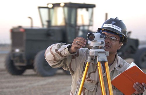
Because banks usually require a land survey before they approve a mortgage loan, most homeowners are acquainted with property surveys. Performed by a licensed land surveyor, these surveys confirm the legal boundaries of residential and commercial properties. Because buying and selling properties is an everyday occurrence, this service keeps surveyors busy all year round. With that said, there are many other surveying services they provide.
ALTA Surveys
A more comprehensive property survey, the ALTA survey includes mortgage, boundary, and topographic surveys. More commonly used for commercial properties, these surveys are popular because they guarantee a single, universal standard all companies can agree on.
Mortgage Surveys
Mentioned earlier, mortgage surveys determine the land boundaries of a property. They can also calculate the location of any structure, such as a home, apartment building, or condominium that is located on the land. The main reason lending institutions require these surveys is because they want to make sure any structures on the property meet current building and zoning codes.
Topographic Surveys
Used to pinpoint the location of both natural and man-made features, topographic surveys are sometimes required by the government. They generally include trees, streams, fences, and detached structures. Much like some maps, they use contour lines to indicate relative elevation. Often used by architects and engineers, topographic surveys help them plan certain projects more precisely.
Construction Surveys
Important tools through the entire construction process, surveys help engineers, builders, and architects plan their next steps. All projects begin with a site or plot plan that lays out the plan for the entire project, from start to finish. There are also as-built surveys that confirm that all authorized work was completed according to the specifications set forth in the plot plan. Lastly, a foundation survey is completed as soon as the foundation of the building has been cured. Its purpose is to verify that the foundation was poured in the proper location and according to accepted standards.
Deformation Survey
Generally used on public lands, such as parks, a deformation survey helps determine if an object or structure is changing shape or moving. If, for example, a birdwatching tower were believed to be sinking into the ground, a land surveyor would record the specific points of the tower in order to determine its exact position. He or she would then wait for a certain period of time before retaking the measurement points. If the points were different, the surveyor would report that the tower is indeed sinking.
Hydrographic Survey
It may make their job title a misnomer, but land surveyors also perform bathymetric and hydrographic surveys on bodies of water. To do so, they must measure things like water depth, water levels, bottom contours, and direction of the current (if there is one). For navigational purposes, they must also record the location and position of landmarks and other fixed objects.
Although this is only but a partial list, the aforementioned options are the most common types of land surveys.


